Dichanthelium acuminatum
Common name: tapered rosette grass, Western panicum, Western witchgrass, Western panicgrass.
Abbreviation code (Codon): DIAC
| Dichanthelium acuminatum | |
|---|---|

| |
| Dichanthelium acuminatum | |
| Scientific classification | |
| Kingdom: | Plantae |
| Subkingdom: | Tracheobionta |
| Phylum: | Spermatophyta |
| Subphylum: | Magnoliophyta |
| Class: | Liliopsida |
| Subclass: | Commelinidae |
| Order: | Cyperales |
| Family: | Poaceae |
| Genus: | Dichanthelium |
| Species: | Dichanthelium acuminatum |
Description
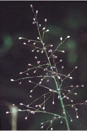
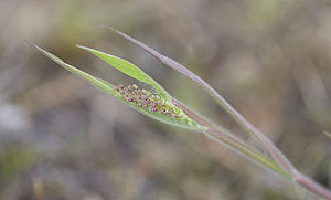
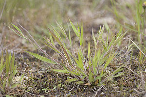
Tufted perennial; stems yellowish-green, leafy towards base, spreading, usually velvety-hairy, 15-40 cm tall. Leaves flat, firm, erect to ascending, hairy, 5-10 mm wide, no auricles; ligules 3-4 mm long, consisting of long hairs.
Inflorescence a panicle, open, 3-9 cm long; spikelets up to 2 mm long, short-hairy, two flowered, the lower flower sterile; glumes unequal in size; fertile lemmas hardened (Pojar and MacKinnon, 1994)
Bloom Period
June-September
Dichantheliums are characterized by two distinct blooming periods. The conspicuous primary flowering heads are terminal to the culms and are produced in late spring and early summer. Secondary flowering heads are produced from the leaf axils begininning in mid-summer and continuing into early autumn. The primary flowering heads usually have a lower seedset than the secondary ones, which have flowers that remain closed and are self pollinated. However, seeds produced by the primary flowers appear to germinate more readily than seeds from the secondary flowers.
(nativeplantnetwork.org)
Distribution
Southern British Columbia south along the coast to California; east of the Cascades mainly along water courses or around springs in the mountains, east to Montana and Wyoming.
Habitat
Rocky or sandy river banks or lake margins to open woods, marshy areas or dry prairies, from sea level to high elevation in the mountains. Moist, sandy ground (lakeshores, beaches, stream banks), rocky and gravelly areas in bogs, meadows and open forests at low to mid elevations Cite error: Closing </ref> missing for <ref> tag


